Google has added estimated fuel cost to driving directions in its Google Maps.I would never have picked this up had Techradar.com not covered it as we gave up having our own car years ago and Google does not appear to have advertised this feature in the obvious places.
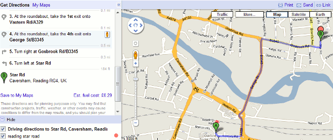
If you want to go from A to B and are using Google maps, choose the driving directions as usual and Google gives you the estimated fuel cost at the bottom of the directions.

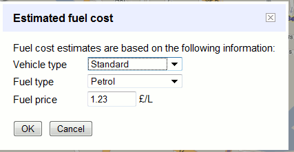
In this case Google tells me that it would cost someone 29 pence to drive from Reading railway station to where I live in Star Road. If you want to see how Google has calculated that then click on the Est. fuel cost link.

The default for vehicle type is standard. The other two options are Compact and High Consumption. Fuel type by default is petrol but you can change it to …erm.. just diesel. So no LPG, nor is there any differentiation between unleaded and super unleaded, diesel and premium diesel. Neither is it clear where the price has come from, and if you change the fuel type the fuel price does not change. You can, though, change the price manually.
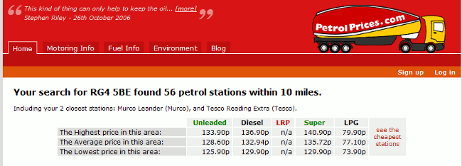
To check the local prices of all types of fuel go to Petrolprices.com. (See my 2005 posting at http://www.rba.co.uk/wordpress/2005/11/18/see-cheapest-uk-petrol-prices-for-free/)

At best the trip from the railway station to my road in a compact car that uses LPG would cost 12 pence. At worst and using a high consumption care with the most expensive fuel the cost would be 55 pence.
Of course this is never going to be totally accurate, so it is useful only as a general indication of the likely cost of your journey. As I no longer drive my own car I am not the best person to comment on this aspect. But it does seem to me that you have to fiddle around rather a lot with the settings before Google gives you anything that remotely resembles the true cost. I would be interested in comments from regular drivers on how helpful – or not – this addition to Google Maps is.