I travel a lot for both business and leisure and I use public transport whenever possible. The plus side to this is that if it is a longish journey – for example Reading to Manchester – I can settle down on the train and get on with some work. The down side is that I have to know my way around the transport networks, not just in the UK but also in the other countries I visit. After over 20 years of business travel I have a range of tools and timetables bookmarked on my laptop plus the really useful stuff inside my head gained from experience. For example, the easiest route is not always the quickest: a single cross country stopping train may take longer but the seemingly quicker alternative of three changes can be seriously stress inducing and take longer if there are delays, signals failures, “incidents” and you miss your connections. I recently spotted that two of my clients link to Google Transit (http://www.google.com/transit) on their map and directions pages so I thought I would give it a go. You do not have to go to the Google Transit page to start using this; if you are already on Google Maps and are looking for directions from A to B, choose the middle “By public transport” icon. So let’s try a journey from Reading railway station to Milton Keynes.
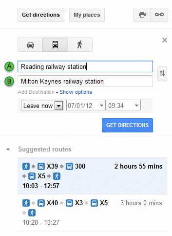
Well I didn’t expect that: a 3 hour journey using 3 buses. Running the journey through the Google Transit page itself the journey time increases to around 3.5 hours and the number of buses to 4.
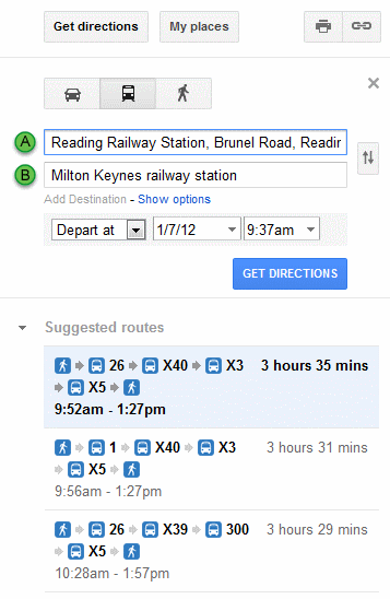
Google is well known for giving different results for the same type of search depending on the route you take but I was perplexed by Google’s insistence that I have to travel by bus. OK, it’s Saturday so there are probably engineering works and buses are probably the best option. I checked the National Rail web site (http://www.nationalrail.co.uk/):
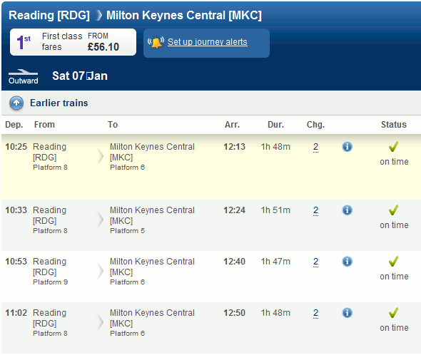
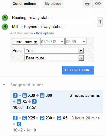
No problem it seems. My train journey via London would take just under 2 hours. Perhaps bus transport is Google’s default option? Underneath the ‘B’ location is ‘Add Destination – Show options’. Click on this and from the ‘Prefer’ box you can choose Any mode of public transport, Bus, Underground, Train, Tram/Light rail. The box underneath offers Best route (no definition as to what ‘best’ means), Fewer transfers, Less walking. No matter what combination of options I selected Google insisted that bus is the only option.
Perhaps Google is confused by the cross-London element of my journey even though Underground is one of the ‘Prefer’ options. Let’s look at a simpler journey: Reading to Crowthorne. I frequently travel along this route and it is a straightforward journey by rail taking 14 minutes as confirmed by National rail.
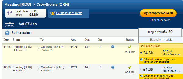
Google, however, insists that it requires two buses and 1.5-2 hours!
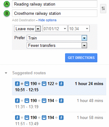
I tried other routes and it seems that Google, in the UK at least, thinks that public transport means bus despite the ‘Prefer’ options it offers. This could be useful, though, if there is a rail strike and you need to identify alternative means of transport. Or you could go straight to Traveline (http://traveline.info/).
